


China Matters’ Features: An astrophile of “chasing” space station
Read also
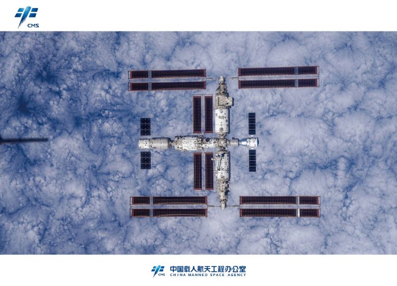
DUSHANBE, 30.11.2023 (NIAT Khovar) – On November 28th, China’s Tiangong space station has been photographed in its complete form for the first time. The space station’s main purpose is for scientific research.
In 1992, the Chinese government proposed a “three-step” strategy for aerospace engineering. Three decades later, from the Tianyan telescope, to the Tiangong space station, and the Tianwen-1 mission, China has steadily marched forward to unravel more mysteries of the universe.
Liu Boyang, a doctor of astrophysics, has been recording the changes of China’s space station as an astrophile. In April 2022, with self-developed optical tracking technology, Liu successfully captured a high-definition close-up image of the space station. Since then, he has traveled with his equipment to over 10 cities across the country, and photographed a total of 12 configurations.
In this video, China Matters portrays Liu Boyang’s latest and previous experience of photographing the configuration of Tianzhou-5 and Tianzhou-6 cargo spacecrafts, the largest configuration so far.
Meanwhile, the story of why Liu Boyang took up his journey of chasing China space station and his dedicated efforts to record all kinds of configurations will be unveiled.
In what way is Liu Boyang going to continue his efforts about China’s space station? What plans does he have for this dedication?
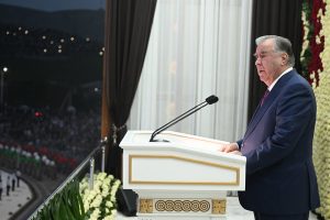 Emomali Rahmon Calls for Strengthening Patriotism Among Youth at Navruz Celebration
 Tajikistan, Uzbekistan Discuss Expanding Customs Cooperation
 Tajikistan Eyes Renewable Energy Boost With 500-MW Solar Initiative
 Experts to Discuss Climate Resilience at Dushanbe Water Conference
 Meeting of the Government of the Republic of Tajikistan
 Dushanbe to Host International Forum on Sustainable Development, Green and Digital Transformation in April 2026
 Tajik Delegation Competes at International Delphic Games in Kyrgyzstan
 Tajik, Uzbek Writers Celebrate Navruz at “Literary Friendship – Eternal Friendship” Event
 Dushanbe to Host International Judo Grand Slam 2026
 FAO to Hold 35th Regional Conference in Dushanbe on Food Security, Climate Issues
 Tajik Cinema Days Open in Uzbekistan, Showcasing National Films
 Youth Navruz Festival Opens in Dushanbe with Global Participants, Cultural and Sports Events


