


“Smart City” Presents New ‘Electronic Map of Dushanbe’ Project
Read also

The State Unitary Enterprise “Smart City” has presented a new project titled “Electronic Map of Dushanbe,” featuring analytical and update modules, NIAT “Khovar” reports, citing the State Unitary Enterprise “Smart City.”
During the presentation, participants were introduced to the key features of the project, including examples of geoportals and analytical reports. The stages of implementation and the roles of the institutions involved were also outlined.
The “Electronic Map of Dushanbe” was developed on the instructions of the Chairman of Dushanbe, His Excellency Rustam Emomali, and is being implemented by the State Unitary Enterprise “Smart City” under the Executive Body of State Authority of Dushanbe, in cooperation with LLC “GS Era.” As part of the project, the territory of Dushanbe is being surveyed using unmanned aerial vehicles and converted into digital format.
An electronic map is a cartographic product generated from digital map data and includes information on geodetic points, terrain, hydrography, vegetation, soils, economic and cultural sites, roads, communications, urban infrastructure, administrative boundaries, and other geographic features.
 President Emomali Rahmon Remotely Launches Four New Facilities in Sughd Province
 Green Climate Fund Approves $190 Million in New Projects For Tajikistan Following Dushanbe Meeting
 Tajik, Russian Lawmakers Discuss Labor Migration and Bilateral Cooperation
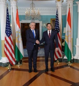 US, Tajikistan Explore Trade, Investment and Security Cooperation
 Tajikistan, US Reaffirm Commitment to Strengthen Bilateral Relations
 Tajikistan Exports Nearly 37,000 Tons of Dried Fruits in Early 2026
 Tajik-French Archaeological Expedition Yields New Finds in Rasht Valley
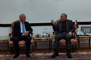 Tajikistan, Iran Discuss Expanding Bilateral Cooperation in Tehran
 Tajikistan, IMF Discuss Economic Policy and Reforms
 Tajikistan, World Bank Discuss Rogun Hydropower Financing in Vienna
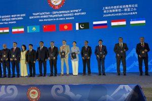 SCO Seen as Key Platform for Investment, Tajik Official Says
 Tajikistan Building Two 500-MW Solar Plants, Energy Minister Says


